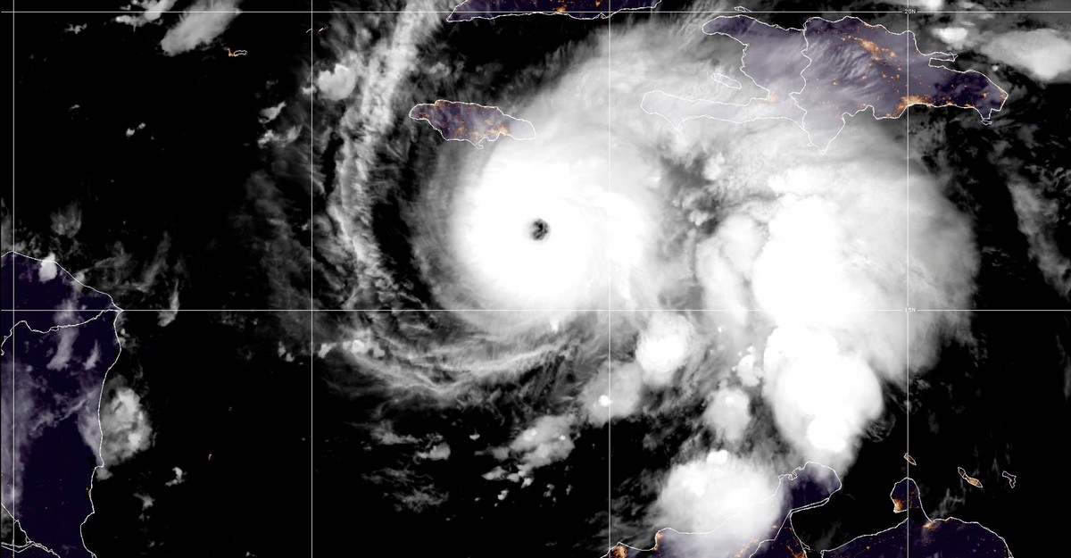
"Hurricane Melissa is moving slowly. It reached the coast of Jamaica this afternoon after stalling out over the Caribbean Sea for the past two days. And yet, the winds that form Melissa are shockingly fast. At 10:00 this morning, the National Hurricane Center reported that maximum sustained winds had reached 185 miles an hour-surpassing those of any other storm this year, along with Hurricane Katrina."
"Andy Hazelton, a hurricane hunter and modeler at the University of Miami, told me he has been flying morning missions into Melissa's eye since Saturday. (I am a journalist-in-residence at the University of Miami but have not previously collaborated with Hazelton or any of the other hurricane experts I contacted for this story.) Yesterday morning, turbulence was so intense that his flight had to turn back. "That's happened in the past. It only happens in extreme hurricanes," he said."
Hurricane Melissa stalled near Jamaica while its maximum sustained winds reached 185 miles per hour, matching the strongest storms of the year. The storm rapidly intensified, with winds doubling from 70 to 140 mph in one day and later rising above 175 mph to Category 5 strength. Melissa is forecast to hit Jamaica, eastern Cuba, and parts of the Bahamas with catastrophic flash flooding, destructive winds, and damaging waves, and local leaders warn that infrastructure cannot withstand such impacts. Meteorological observations noted extreme turbulence during reconnaissance flights. Slow storm motion typically weakens hurricanes by upwelling cold water, but unusually warm Caribbean sea-surface temperatures sustained Melissa's strength.
Read at The Atlantic
Unable to calculate read time
Collection
[
|
...
]