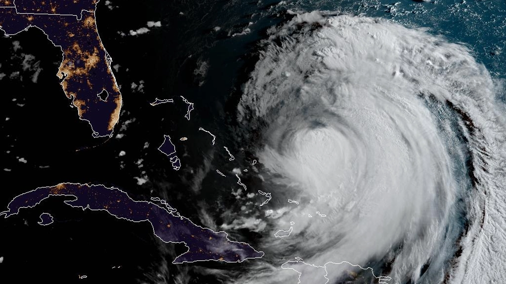
"Hurricane Erin is maintaining sustained winds of 65 mph and is projected to remain offshore, but will influence coastal flooding and danger from rip currents along the East Coast."
"Tropical storm-force winds are anticipated to reach the Outer Banks by late Wednesday or early Thursday, which could result in storm surge levels peaking at 2 to 4 feet in low-lying regions."
"The National Hurricane Center warns of life-threatening rip currents along beaches from Florida to Rhode Island, with heavy rain and gusty winds expected from Thursday to Friday."
"While direct impacts are unlikely along the East Coast, Hurricane Erin’s effects could still reach hundreds of miles inland, affecting various states along the coastline."
Hurricane Erin, with sustained winds of 65 mph, poses a threat to the U.S. East Coast as it moves northward, causing coastal flooding and hazardous surf conditions. Tropical storm warnings and storm surge alerts are issued for the Outer Banks, with predicted surge levels of 2 to 4 feet. Even though the storm is not expected to make landfall, areas from eastern New Jersey to southern New England should monitor it closely. The storm has already impacted the Caribbean with flooding rains and is likely to affect regions well inland.
Read at Shore News Network
Unable to calculate read time
Collection
[
|
...
]