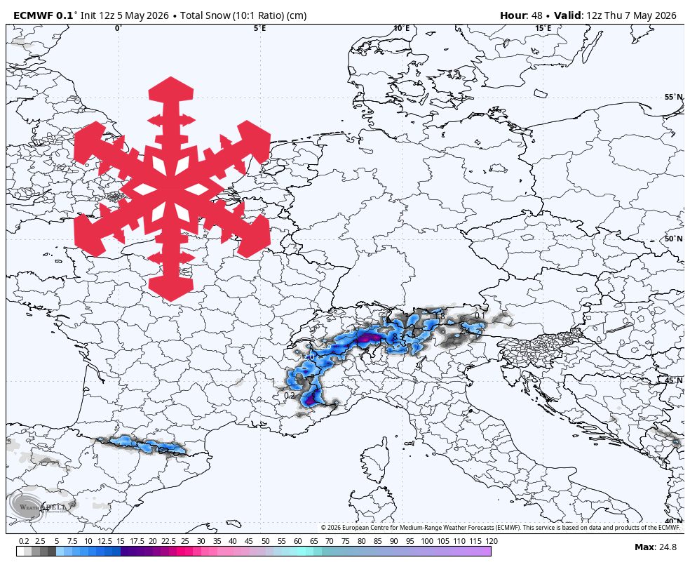
"The best near-term snow favors the western and central high Alps, while the lower northern and eastern margins see much lighter totals or only a trace. Confidence is highest from Tuesday night, May 5, through Thursday midday, May 7, when timing and snow levels are best aligned."
"The current wave continues Tuesday night into Wednesday, with the models converging on the main burst from early Wednesday morning through Wednesday evening. They agree on snow levels mostly around 1,800-2,200 meters during snowfall, with the best accumulation above the mid-mountain elevations."
"Thursday afternoon through Saturday looks comparatively quieter, and the models agree the first wave winds down quickly after Thursday morning. Leftover flurries should be limited and ski quality will depend more on elevation, aspect, and recent snow preservation than fresh accumulation."
"Next week carries a broader, less certain signal, with many higher Alpine zones broadly in play for 10-30 cm from Monday night through Friday if the colder trough organizes."
A high-elevation storm is affecting the European Alps, particularly the western and central regions, with significant snowfall expected from May 5 to May 7. Snow levels are forecasted between 1,800-2,200 meters, with the best accumulation above mid-mountain elevations. After Thursday, conditions will quiet down, with leftover flurries and ski quality depending on elevation and recent snow. Next week presents uncertainty, with potential for 10-30 cm of snow if colder air organizes, but models diverge on timing and intensity.
Read at SnowBrains
Unable to calculate read time
Collection
[
|
...
]