"Friday morning through early Saturday will see the steadiest initial burst of snow, with snow levels rising to around 1,900 to 2,100 meters during the mildest part of the storm. This will keep the best accumulation on higher terrain, especially at Lake Louise and Banff Sunshine."
"As colder air works in Saturday and Sunday, snow levels will crash below 1,000 meters and snow-to-liquid ratios will improve into the 12-18 range, resulting in drier, more skiable snow by the end of the weekend."
"The next round of snow is already signaled for Tuesday into Thursday, with guidance converging on bringing snow back during that stretch, although diverging on intensity and timing."
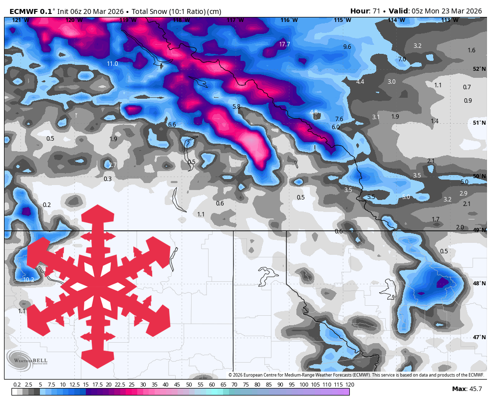
A two-part weather pattern will deliver fresh snow to Ski Big 3 this weekend, starting with a warm dense phase on Friday followed by colder conditions into Sunday night. The best accumulations are expected at Lake Louise and Banff Sunshine, with totals of 14-18 cm by Sunday night. After a cold lull on Monday, another round of snow is anticipated midweek, with potential accumulations of 10-25 cm, particularly favoring Lake Louise. Snow levels will fluctuate, impacting snow quality throughout the weekend.
Read at SnowBrains
Unable to calculate read time
Collection
[
|
...
]