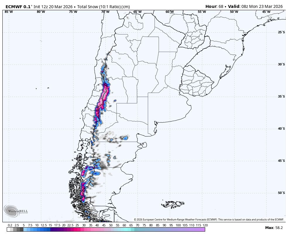
"From Friday afternoon through Sunday night, guidance is well aligned on a prolonged but not especially cold storm for Portillo, Valle Nevado, El Colorado, La Parva, and Las Leñas. Timing confidence is solid, with snow starting quickly Friday and continuing in waves into late Sunday."
"The bigger divergence is snowfall intensity, especially around Valle Nevado, El Colorado, and La Parva where the driest guidance is much leaner than the wetter camp. Higher terrain should do best and Portillo is the most vulnerable to denser snow near the lower mountain."
"Exposed terrain around Valle Nevado and La Parva can still see gusts near 40 to 50 km/h during the steadiest periods, and a reasonable expectation is around 25 cm at Valle Nevado with low-20s at El Colorado, La Parva, and Las Leñas."
From Friday afternoon to early Monday, a storm cycle will deliver snow primarily to the Chilean Andes and Las Leñas. Snow levels will remain low, ensuring mostly snow at higher resorts. The best conditions will occur later in the weekend at Nevados de Chillán and Corralco. Patagonia and Tierra del Fuego will see minimal accumulation. Confidence in forecasts decreases after Monday as the central Andes quiet down. Several resorts remain closed, making this storm more relevant for preseason coverage than immediate skiing opportunities.
Read at SnowBrains
Unable to calculate read time
Collection
[
|
...
]