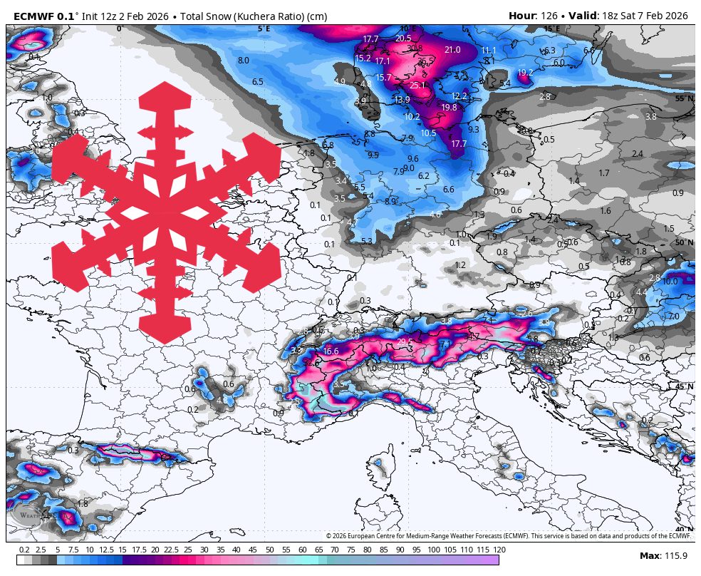
"Snow levels generally sit near 3,000 to 5,000 feet, which keeps most upper mountain terrain in play while the lowest villages in Austria flirt with wetter snow during the warmest pulses. Snow quality looks best on the highest, coldest terrain on the Italian side, where SLRs run in the mid to upper teens, while the Dolomites and some lower Austrian zones lean denser with SLRs closer to 10 to 13:1."
"Monday night into Tuesday brings a quick refresher, with the Italian side of the Matterhorn favored for the lightest snow. Temperatures stay cold enough for snow at most elevations, and snow levels hover in the 3,000 to 3,600 feet range for the western Alps, so accumulation should extend well down the mountain at the higher resorts. SLRs in places like Cervinia trend in the mid to upper teens, which points to noticeably lighter, drier snow than the lower-SLR pockets farther north and west."
The Alps will be active with light snow early, a stronger midweek push, and a lower-confidence multi-day window late Sunday into mid-next week. Snow levels generally range from 3,000 to 5,000 feet, keeping most upper mountain terrain snow-covered while the lowest Austrian valleys may see wetter snow during warm pulses. SLRs run mid to upper teens on the highest Italian terrain producing lighter, drier snow; the Dolomites and lower Austrian zones trend denser with SLRs near 10 to 13:1. Monday night into Tuesday favors the Italian side of the Matterhorn, with cold temperatures and accumulation down to 3,000–3,600 feet. Wednesday through Saturday offers the best chance for meaningful new snow, with Cortina targeted and a Thursday–Friday wave expected into France and western Switzerland. Winds are mostly manageable, though Val Thorens can experience stronger ridge-top winds that may affect lift comfort.
Read at SnowBrains
Unable to calculate read time
Collection
[
|
...
]