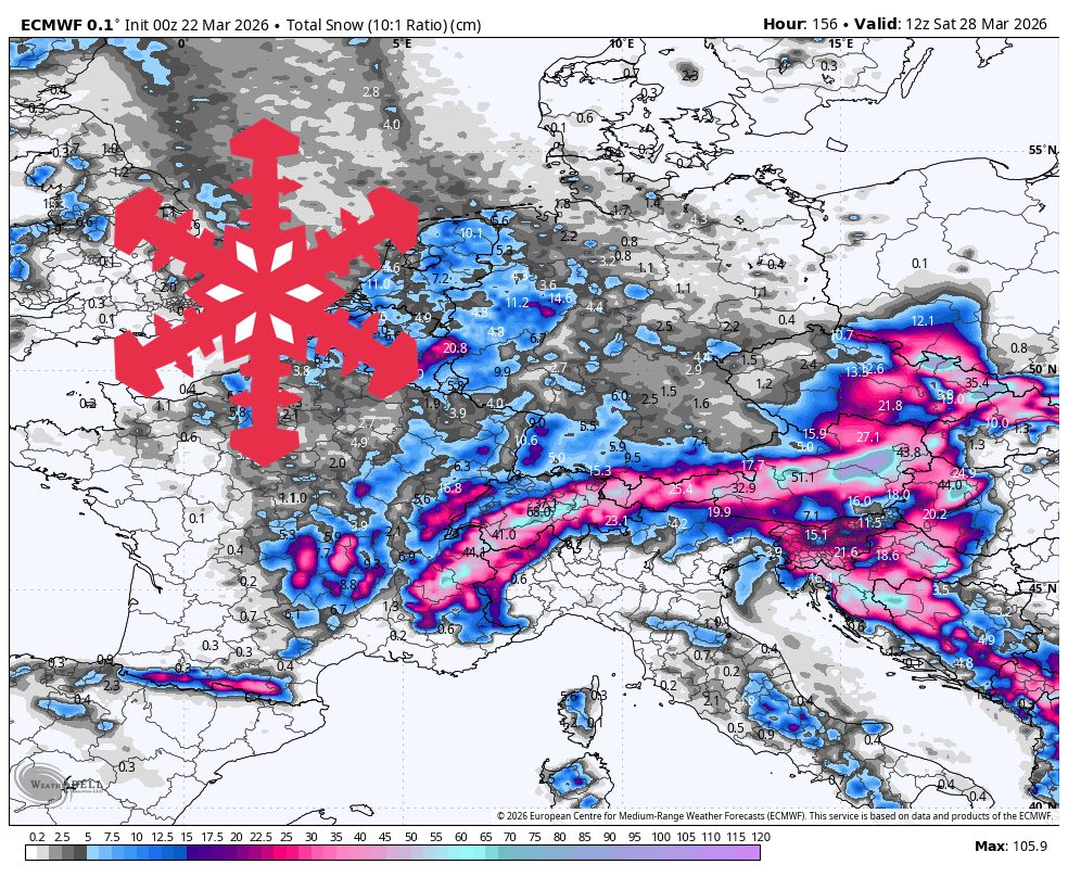
"A widespread storm is expected to arrive Wednesday afternoon, intensifying through Wednesday night into Friday. The strongest agreement is on the timing and the sharp drop in snow levels."
"Snow levels will start around 1,000 to 1,400 meters Wednesday afternoon, collapsing to valley floors by Wednesday night and Thursday, ensuring nearly all snowfall occurs at resort elevations."
"Many resorts should receive between 30 cm and 60 cm of snow, with favored western and northern areas potentially exceeding these amounts, particularly Wengen, which may see up to 127 cm."
A quiet start transitions to a major snow cycle in the European Alps from March 25 to March 28. Monday and Tuesday will be mostly dry, with light snow showers. A colder storm will arrive Wednesday, dropping snow levels to valley floors by Thursday. Resorts may receive 30 cm-60 cm of snow, with some areas like Wengen potentially seeing up to 127 cm. Winds will increase, creating challenging upper-mountain conditions. A drier weekend will follow after the storm subsides.
Read at SnowBrains
Unable to calculate read time
Collection
[
|
...
]