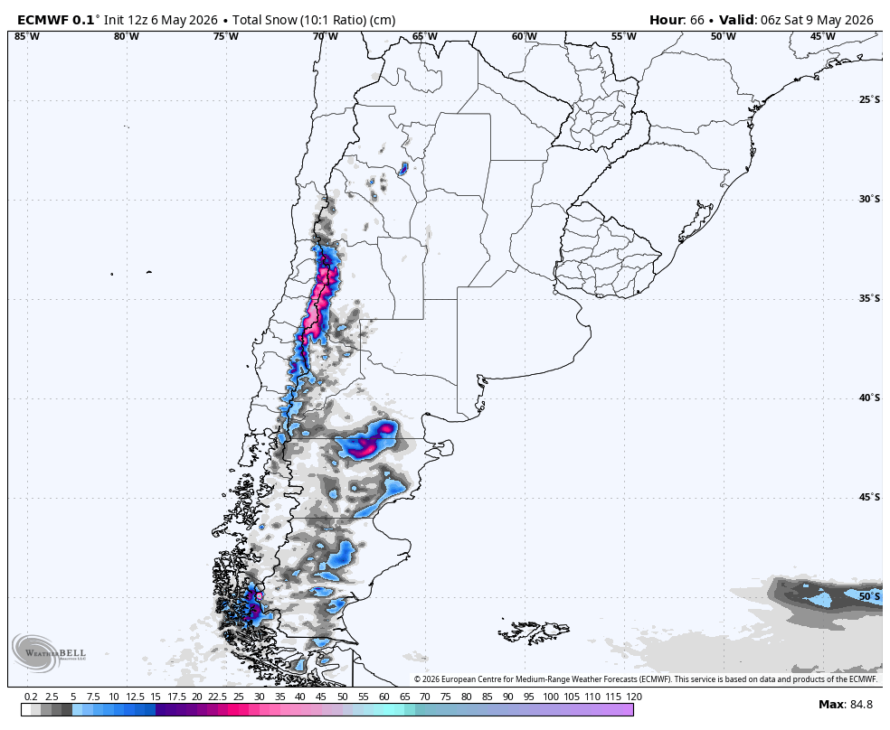
"The storm is already underway across several central and south-central areas, so the next phase is a continuation rather than a fresh start. The individual models are converging on central Chile and Portillo picking up most of their additional snow from Wednesday afternoon through Thursday."
"Farther south, the models agree that the storm lasts longer around Nevados de Chillan and Corralco, with snow continuing in pulses into Friday night. Snow levels there are lower, often near 1,100-1,800 meters during the event, but SLRs are more often in the 5-13 range."
"From Saturday onward, confidence drops as the individual models diverge on the next meaningful snow chances. The central Andes look much quieter overall, with only weak, higher-snow-level chances around midweek."
An ongoing storm in the Andes will continue to accumulate snow through early Saturday, particularly affecting central and south-central regions. Confidence is highest from Wednesday afternoon to early Saturday, with models agreeing on storm structure. Key areas for snow accumulation include Corralco, Nevados de Chillan, Portillo, and Valle Nevado. Snow levels will vary, with denser snow in lower elevations and lighter snow in higher peaks. After Saturday, confidence decreases as models diverge on future snow chances, with a quieter period expected in the central Andes.
Read at SnowBrains
Unable to calculate read time
Collection
[
|
...
]