"The storm is already in progress, with the most organized snow continuing Wednesday morning and then tapering north to south through the afternoon and evening."
"Expect moderate to fairly light snow quality north and denser spring snow south and west, with exposed gusts mostly 15-30 mph and locally near 35 mph."
"Saturday through early next week looks warmer and mostly dry, with only isolated high-country showers."
"Model agreement drops after Wednesday because most guidance keeps this to flurries or less than 1 inch, while one solution tries to produce 1-3 in near the Front Range."
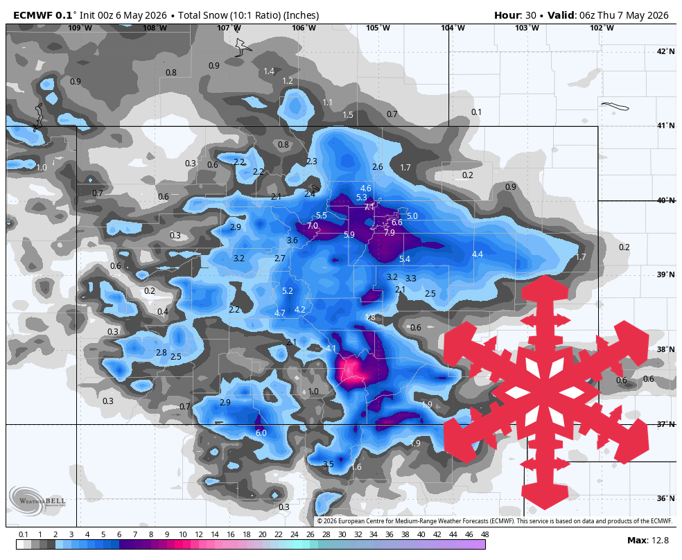
A spring storm is affecting Colorado's mountains, bringing snow through Wednesday. Snow accumulation is expected to be 3-8 inches in many areas, with the heaviest snow in the southern and central mountains. Snow levels will range from 4,500 to 8,500 feet. After the storm, Thursday and Friday will be quieter, with a weak disturbance possibly bringing light flurries. The weekend will see a warm-up with mostly dry conditions and only isolated high-country showers.
Read at SnowBrains
Unable to calculate read time
Collection
[
|
...
]