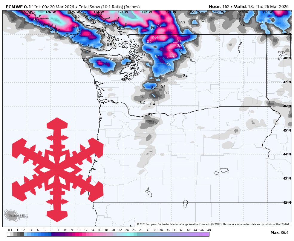
"Confidence is strongest from Tuesday morning March 24 through Thursday morning March 26, when falling snow levels should shift the advantage to Whistler and the Washington Cascades, with Mt Baker and Whistler favored for around 10″-18″ and lighter amounts farther south."
"Friday stays warm and damp before the Cascades cool off quickly Friday night into Saturday. Guidance is tightly clustered on rain lingering through Friday, especially north, with snow levels too high for much help outside the highest terrain."
"Models are converging well on that cooler, drier stretch, with light winds for most resorts and the best surface quality coming from overnight refreeze rather than new snow."
The PNW transitions from a warm, rainy Friday to a cooler weekend, with significant snowfall expected from March 24 to March 26. Whistler and the Washington Cascades are predicted to receive 10-18 inches of snow, while Oregon resorts may remain drier. Friday will be warm and damp, with snow levels dropping to 2,000-4,000 feet by Saturday. The weekend will be quiet, with limited snowfall, but a wetter Pacific front is anticipated next week, bringing better skiing conditions.
Read at SnowBrains
Unable to calculate read time
Collection
[
|
...
]