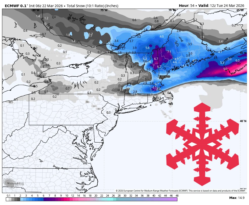
"Confidence is highest from Sunday morning, March 22, through Tuesday morning, March 24. The models are converging well on steady snow through Sunday afternoon, then a taper Sunday night before colder snow showers redevelop Monday afternoon and Monday night."
"The safest call is for roughly 8″-18″ across western Maine and the White Mountains by Tuesday morning, around 7″-9″ for the higher northern Vermont peaks, and just 2″-4″ in the southern Greens."
"Tuesday is the cleanest reset day, with colder temperatures and much lighter precipitation after the early-week snow winds down. Most guidance keeps Tuesday largely dry beyond a few lingering morning flakes."
A productive late-season cycle will enhance skiing in northern New Hampshire and western Maine through Tuesday morning. Vermont will experience uneven snow conditions. Sunday is expected to have steady snow, tapering off at night, followed by colder snow showers on Monday. Confidence is high for significant snowfall in western Maine and the northern Whites, while lower elevations may see mixed precipitation. Tuesday will be a reset day with lighter precipitation, and grooming conditions should improve. A weak front will pass through on Wednesday, leading to light snow.
Read at SnowBrains
Unable to calculate read time
Collection
[
|
...
]